Property Record
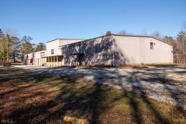
441 Bucksnort Rd, Griffin, GA 30224


NEARBY LISTINGS FOR SALE OR LEASE
Property Detail
441 Bucksnort Rd
Atlanta-Sandy Springs-Roswell, GA
Holman Estates
217-01-008-L
BUCKSNORT RD
Officebuilding
Spalding
X
Georgia
13255C0210E
115
2024
10 AC
2024
S Clayton/Henry Cnty
161000
Atlanta
9,800 SF
DEMOGRAPHICS near 441 Bucksnort Rd
1 Mile
3 Mile
5 Mile
2024 Total Population
198
3,701
11,812
2029 Population
211
3,999
12,757
Pop Growth 2024-2029
+ 6.57%
+ 8.05%
+ 8.00%
Average Age
41
42
41
2024 Total Households
71
1,368
3,892
HH Growth 2024-2029
+ 5.63%
+ 8.19%
+ 8.17%
Median Household Inc
$67,500
$71,978
$68,617
Avg Household Size
2.60
2.60
2.70
2024 Avg HH Vehicles
3.00
2.00
2.00
Median Home Value
$162,962
$174,652
$185,453
Median Year Built
1975
1991
1991
Nearby Places
Map Layers
Map Styles
 Street
 Aerial
- Restaurants
- Banks
- Shops
- Fitness
- Groceries
SALE & LEASE HISTORY
LISTING DATE
SALE/LEASE

Jun 03, 2022
For Sale
Feb 20, 2020
For Sale
Feb 03, 2022
For Sale
Nearby Properties
Address
Land Use
TOTAL SIZE
Lot Size
Zoning
Address
Land Use
TOTAL SIZE
Lot Size
Zoning
10,224 SF
94.51 AC
M-1C
Address
Land Use
TOTAL SIZE
Lot Size
Zoning
840,000 SF
47.88 AC
M-1
Address
Land Use
TOTAL SIZE
Lot Size
Zoning
840,000 SF
31.92 AC
M-1
Address
Land Use
TOTAL SIZE
Lot Size
Zoning
1,000,475 SF
94.51 AC
M-1C
Address
Land Use
TOTAL SIZE
Lot Size
Zoning
80.85 AC
P-M
Address
Land Use
TOTAL SIZE
Lot Size
Zoning
47,180 SF
1.78 AC
C-2
Address
Land Use
TOTAL SIZE
Lot Size
Zoning
45,316 SF
1.69 AC
C-2
Address
Land Use
TOTAL SIZE
Lot Size
Zoning
77.35 AC
AR
Address
Land Use
TOTAL SIZE
Lot Size
Zoning
456 SF
129.42 AC
P-R
Address
Land Use
TOTAL SIZE
Lot Size
Zoning
25,089 SF
19.34 AC
P-M
Address
Land Use
TOTAL SIZE
Lot Size
Zoning
14,052 SF
7.71 AC
C-2
Address
Land Use
TOTAL SIZE
Lot Size
Zoning
297 SF
55.49 AC
C1C
Address
Land Use
TOTAL SIZE
Lot Size
Zoning
2,940 SF
23.62 AC
P-M
Address
Land Use
TOTAL SIZE
Lot Size
Zoning
89.77 AC
M-1
Address
Land Use
TOTAL SIZE
Lot Size
Zoning
66.01 AC
M-1
Address
Land Use
TOTAL SIZE
Lot Size
Zoning
3,513 SF
1.72 AC
C-2
Address
Land Use
TOTAL SIZE
Lot Size
Zoning
65.38 AC
M-1
Address
Land Use
TOTAL SIZE
Lot Size
Zoning
24.74 AC
C-2
Address
Land Use
TOTAL SIZE
Lot Size
Zoning
2,748 SF
0.98 AC
C-2
Address
Land Use
TOTAL SIZE
Lot Size
Zoning
7,686 SF
2 AC
C-1
Address
Land Use
TOTAL SIZE
Lot Size
Zoning
9,600 SF
5.51 AC
AR
Address
Land Use
TOTAL SIZE
Lot Size
Zoning
34.99 AC
M-1
Address
Land Use
TOTAL SIZE
Lot Size
Zoning
25.87 AC
AR
Address
Land Use
TOTAL SIZE
Lot Size
Zoning
80.95 AC
AR
Address
Land Use
TOTAL SIZE
Lot Size
Zoning
2.74 AC
C-2
Address
Land Use
TOTAL SIZE
Lot Size
Zoning
2.72 AC
C-2
Address
Land Use
TOTAL SIZE
Lot Size
Zoning
33.36 AC
M-1
Address
Land Use
TOTAL SIZE
Lot Size
Zoning
2,412 SF
2.15 AC
C-2
Address
Land Use
TOTAL SIZE
Lot Size
Zoning
290.41 AC
AR1/R2
Address
Land Use
TOTAL SIZE
Lot Size
Zoning
178.20 AC
The World's #1 Commercial Real Estate Marketplace
Connect with us
© 2025 CoStar Group
The information above has been obtained from sources believed reliable. While we do not doubt its accuracy we have not verified it and make no guarantee, warranty or representation about it. It is your responsibility to independently confirm its accuracy and completeness. Any projections, opinions, assumptions, or estimates used are for example only and do not represent the current or future performance of the property. The value of this transaction to you depends on tax and other factors which should be evaluated by your tax, financial, and legal advisors. You and your advisors should conduct a careful, independent investigation of the property to determine to your satisfaction the suitability of the property for your needs.